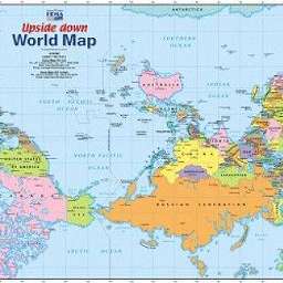
Throughout all our years of school, whenever we looked at a map of the world, be it huge on the wall or small in a book, it was always oriented the same. North Pole was up. Always. But are all maps that way??

This is kinda fuzzy but you will get the idea. On our recent trip to New Zealand, I spotted this big map on the wall at a resort. And it stopped me in my tracks! I’d never seen a map like this with the North Pole at the bottom. Have you ever seen a map like this? And if you’re a “map-o-phile” you will love it.
Google “upside down map” and you’ll find a clearer, better image and you can even order one for your own collection. (Russia is how many times the size of America????)
A more accurate map than the Mercator projection shown, upside down or right side up, is the Fuller Dymaxion Projection.