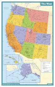
Rick Sayre was the second principle speaker at the Montana State Genealogical Society Conference in Great Falls in 2018. One of his topics was “Mapping the West.”

The history of how maps of the American west came to be is a fascinating, stand-alone, topic. As we zoom along I-90 or I-70, we can barely imagine plodding along on a horse trying to map the vast terrain. (Watch Smithsonian Channel’s Aerial America where they fly over a state and narrate the history.)
Rick stressed the importance of using maps in genealogy: (1) locate and visualize ancestors in time and place; (2) locate boundaries, towns and geographical features; (3) locate and plat land parcels; (4) discover and follow family groups; (5) Identify migration routes; (6) discover the social context of our ancestors; (7) Organize and correlate disparate pieces of the puzzle.
This is “old news” to most of you, I’m sure. The “new news” is that “the variety of maps and map related tools available for research in the Western states include cadastral, topographic, fire insurances, military, gazetteers and atlases.”